Lists & Segments
Claritas Divided the Country into Forty Clusters
Jonathan Robbin's PRIZM system, launched by Claritas in 1974, attached lifestyle-cluster labels to ZIP codes using census data — 'Young Influentials', 'Blue Blood Estates' and thirty-eight other segments that a mailer could buy.

PRIZM attached forty cluster labels to ZIP codes out of census data, and sold them by the segment.Photo: Beate Vogl / Pexels
How Jonathan Robbin's PRIZM system turned the ZIP code into a lifestyle address
When the United States Bureau of the Census enumerated Americans in 1970, it did what it always had: counted heads, recorded occupations, noted income ranges, tallied housing units, tracked educational attainment by county, city block, and census tract. What it did not do was tell a mailer in Chicago which households in Wichita were likely to subscribe to a boating magazine and which were more likely to order a seed catalogue. That inferential step — joining demographic structure to consumer behaviour — was the problem Jonathan Robbin set himself when he founded Claritas in 1971 and began work on what would become the PRIZM system, launched commercially in 1974.
Robbin's starting point was the ZIP code, the five-digit Zone Improvement Plan identifier that the United States Post Office had introduced in 1963 to route mail efficiently. The ZIP code was not designed as a demographic instrument; it was a sorting tool. But it created geographic units small enough to exhibit meaningful social uniformity and large enough to contain statistically useful sample sizes. Robbin recognised that when census variables — income, education, household composition, occupation, housing tenure — were aggregated at the ZIP-code level and subjected to cluster analysis, the roughly forty thousand ZIP codes in the country collapsed into a far smaller number of distinct social types. His arithmetic produced forty clusters. PRIZM, which stood for Potential Rating Index for ZIP Markets, gave each cluster a name designed to convey its character at a glance.
Forty Labels for a Nation
The cluster names were a deliberate act of communication. 'Blue Blood Estates' described the wealthiest suburban enclaves — high incomes, large houses, college-educated professionals. 'Young Influentials' captured the early-career, urban-adjacent households that advertisers pursuing the eighteen-to-thirty-four demographic had struggled to isolate. 'Shotguns and Pickups' — a label that would attract later criticism for its bluntness — identified rural working-class communities in the interior South and rural Midwest. 'Bohemian Mix' pointed to dense, renter-heavy urban neighbourhoods with high proportions of artists, students, and single-person households. Each name encoded a profile; each profile encoded a prediction about what that population bought, watched, read, and responded to.

Before the file there was the drawer: the broker's card index, rented by the thousand names.
Photo: Tima Miroshnichenko / Pexels
The construction behind the names was considerably less poetic. Robbin and his team at Claritas, operating initially out of Washington, D.C., fed 1970 census variables into a statistical cluster algorithm that grouped ZIP codes by the similarity of their demographic fingerprints. The resulting forty groupings were then cross-referenced against consumer survey data and subscription records to establish which clusters indexed highly for which categories of purchasing behaviour. A mailer renting a list of, say, magazine subscribers could append PRIZM codes to those records and discover not just who had already responded but which unrented ZIP codes shared the same cluster profile — in effect, using past response to predict future response in addresses never yet mailed.
This was a structural departure from the way list selection had worked before. The dominant practice through the 1960s was to rent response lists — people who had bought from a similar catalogue — or compiled lists assembled from phone directories, automobile registrations, or professional directories. The quality of a rented list was judged by the recency, frequency, and monetary value of its members' prior purchases, the RFM framework that Robert Kestnbaum and others had formalised in the 1960s. RFM was a verdict on known customers; PRIZM was a geography-based probability assigned to strangers. A mailer using PRIZM could target entirely cold ZIP codes on the grounds that their cluster membership made them structurally similar to ZIP codes that had responded well before.
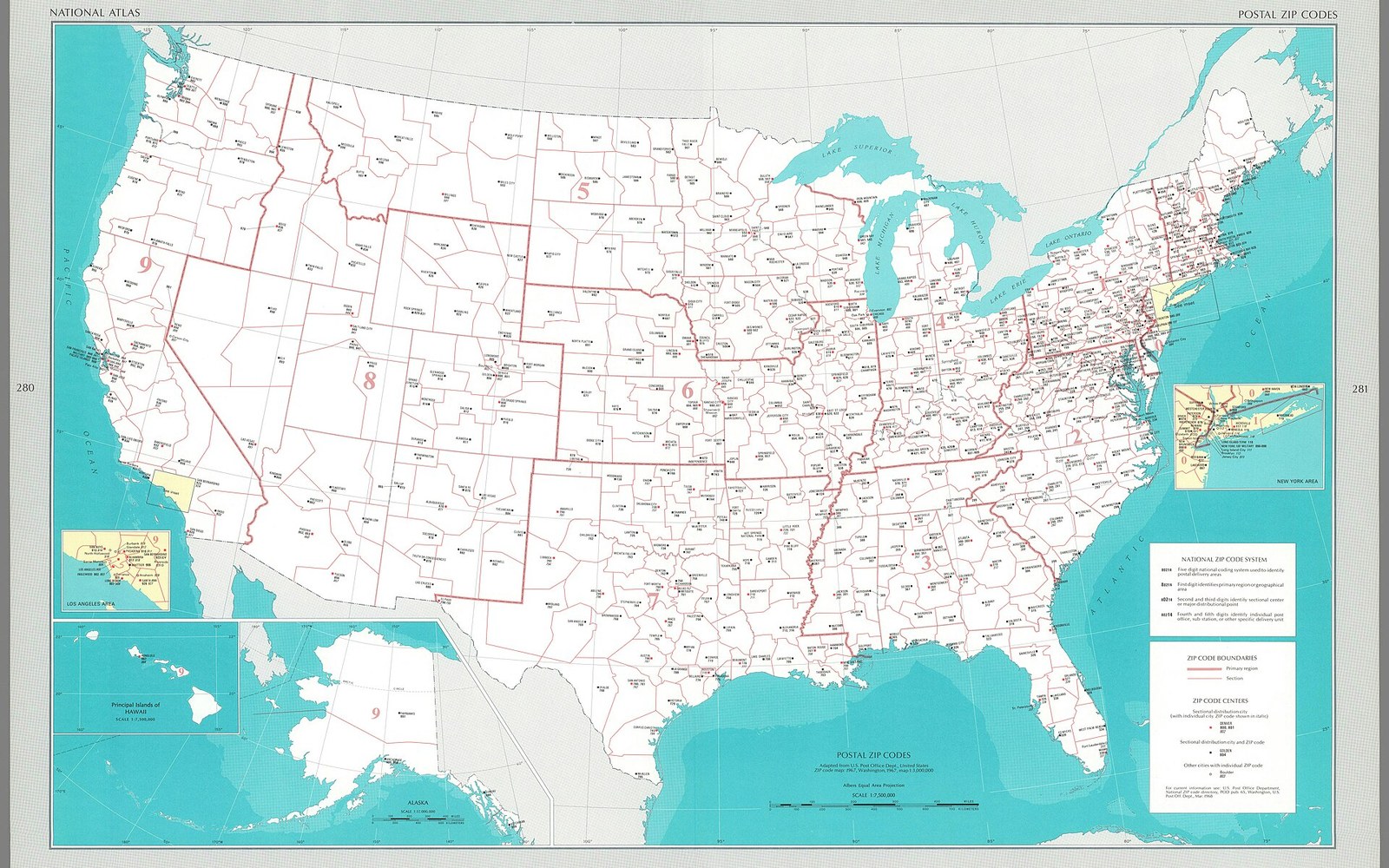
Five digits, and a mailing list could be sorted, aggregated and matched against the census.
Photo: Postal zip codes - adapted from U. S. Post Office Dept., United States ZIP code map- 1967, Washington, 1967, map 1-3,000,000. (IA dr postal-zip-codes-adapted-from-u-s-post-office-dept-united-states-zip-14359211) · Wikimedia Commons
What It Displaced, and What It Built
Before geodemographic segmentation of this kind existed, targeting a cold geography meant relying on intuition, regional sales-force knowledge, or crude demographic breakdowns — urban versus rural, North versus South, median-income bands drawn from county-level data. The precision was low; the waste was high. A catalogue company sending to all households in a metropolitan area was paying postage and print costs for large numbers of people whose cluster profile made them statistically unlikely to respond. PRIZM offered, for the first time, a principled basis for selecting which ZIP codes to include and which to suppress.
The commercial appetite for the system was substantial. List brokers began offering PRIZM-coded overlays as a standard data enhancement service by the late 1970s. By appending a cluster code to each record on a house file, a mailer could see the cluster distribution of its own customer base — and then, by identifying which clusters were over-represented relative to their share of the national population, could construct a targeting model for prospecting. If 'Young Influentials' ZIP codes were responsible for twelve percent of current customers but represented only four percent of the national ZIP-code universe, the rational prospecting strategy was to weight new mailings toward that cluster.
Jonathan Robbin's geodemographic approach ↗ spread beyond direct mail into retail site selection, political campaign planning, and broadcast media buying. A television station could describe its signal coverage area in PRIZM terms; an advertiser could match those cluster profiles against its customer file and decide how much to pay for time. Nielsen's broadcast audience measurement, which worked from panel-based demographic samples, gained a geographic complement it had previously lacked.
Claritas sold the business to VNU, the Dutch media and information group, in 2000, and the PRIZM system was subsequently updated to PRIZM NE (New Evolution) using 2000 census data, eventually expanding the cluster count to sixty-six segments to reflect the greater demographic complexity the country had accumulated since 1974. The core logic — census-derived cluster assignment, lifestyle labelling, ZIP-code geography — remained intact. Experian, which had built its own geodemographic product, and Acxiom, which integrated cluster codes into its data warehouse, both testified to how thoroughly Robbin's original framework had been absorbed into the infrastructure of data-driven marketing.
The system attracted criticism that was partly methodological and partly political. Methodologically, critics observed that ZIP-code-level aggregation could conceal substantial within-cluster variation: a single cluster might encompass both the prosperous and the struggling sides of the same ZIP code. Labelling a territory 'Shotguns and Pickups' or 'Hard Scrabble' risked encoding cultural assumptions into what was presented as a neutral statistical instrument. These were real limitations, and later versions of the product moved toward smaller geographic units — census block groups, and eventually individual household-level modelling — to reduce the ecological fallacy inherent in ZIP-code averaging.
But the achievement was real. Before 1974, the geography of a mailing list was an administrative fact: addresses existed where customers lived, and the mailer sent to them. PRIZM made geography into an argument: addresses existed in social contexts that predicted behaviour, and those contexts could be mapped, named, and used. That shift — from address as location to address as profile — is the enduring contribution of the Claritas system, and it set the terms on which data-driven targeting, from the merge-purge era through the digital cookie, has operated ever since.